The strangest thing about traveling in Italy is how thoroughly the road system has structured what visitors are allowed to experience. The autostrada connects the cities. The state roads reach the towns. The tourist infrastructure concentrates precisely at the places the roads reach and thins to almost nothing at the places they don't.
This sounds obvious until you understand what it means for the coastline.
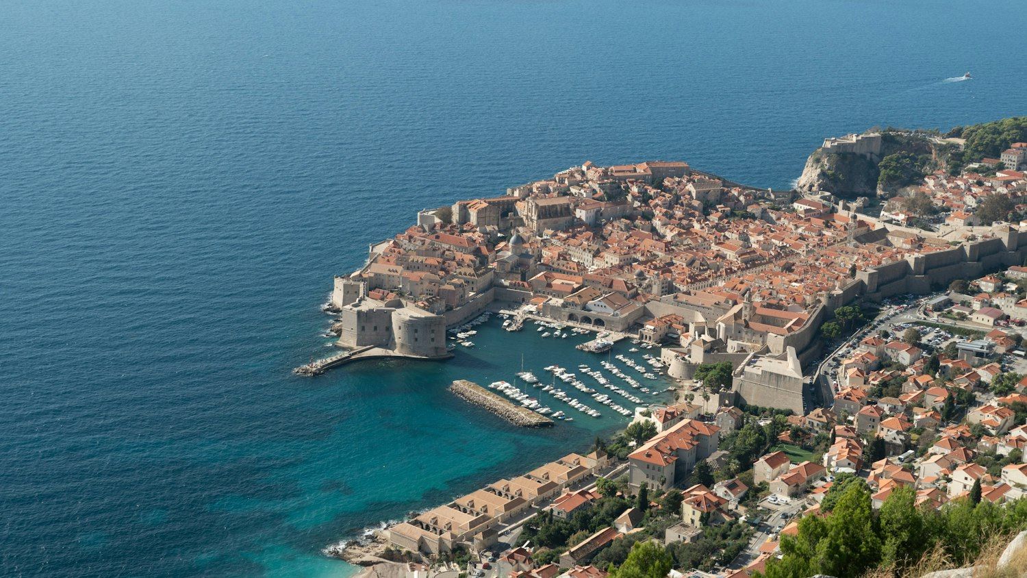
Italy has 4,723 miles of coast — more than any country in southern Europe. A significant portion of that coastline is either inaccessible by road, actively discouraging road access through geography, or technically reachable by car but experienced so incompletely from land that the road version is a different thing entirely from the actual place.
The trullo farmhouses of Puglia visible from the highway are a backdrop. The same coastline seen from a boat anchored in a sea cave near Polignano a Mare is the reason people move to Puglia.
The Amalfi Coast has been photographed from every road-accessible viewpoint so thoroughly that the images have become the place — most visitors arrive already knowing what it looks like and spend the trip confirming the images. The coast from water level is something different.
The cliffs that the road cuts through horizontally are, from a boat below, vertical and overwhelming in a way photographs consistently fail to capture — the camera cannot replicate the vestibular experience of standing in a boat at the base of a 400-meter cliff with nothing above but limestone and sky.
As we covered in The Amalfi Coast Looks Better From the Water, this is consistent across Italy's most famous coastal destinations — the road gives you access to a place, and the boat gives you the place itself.
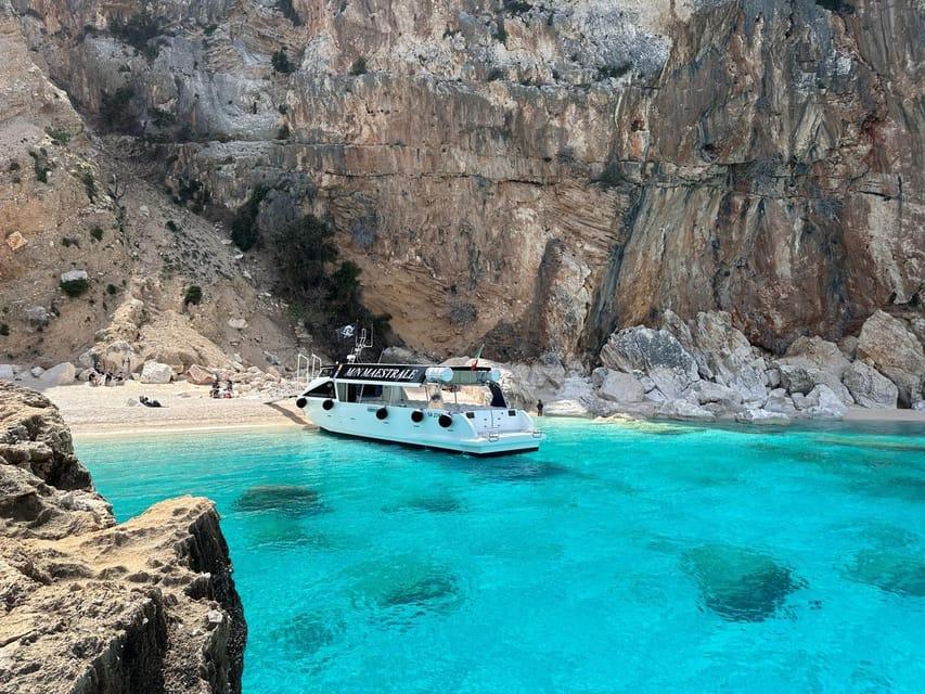
Sardinia takes this further. The Golfo di Orosei on the island's eastern coast contains a stretch of coastline — cliffs, sea caves, and beaches with no road access whatsoever — reachable only by boat or by a multi-day trekking descent. The beaches here, particularly Cala Luna and Cala Mariolu, appear on every list of the most beautiful in Europe. They are not accessible by any means that doesn't involve significant physical effort or a boat charter from Cala Gonone.
Sicily's southern coast — the stretch below the Valley of the Temples at Agrigento — offers something no road delivers: the approach to the Greek temples from the sea, the direction from which Phoenician traders first encountered this coastline. The temples are extraordinary from the archaeological site. From a boat approaching offshore, they are extraordinary in a completely different register.
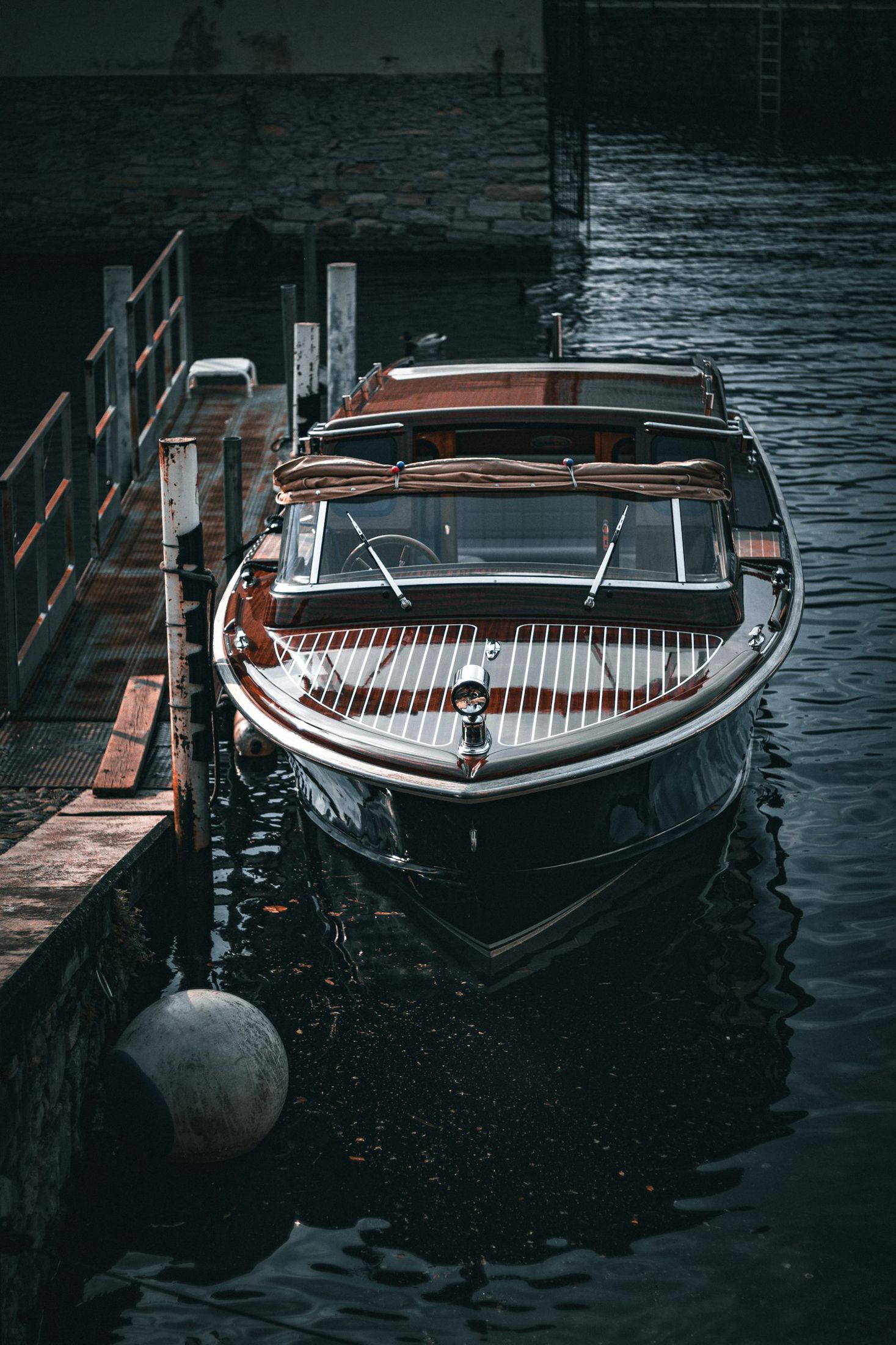
Italy's boat charter and rental market is simultaneously one of the most developed in the Mediterranean and one of the least consolidated digitally. Operators in Sicily, Sardinia, Puglia, and the Amalfi Coast range from sophisticated charter companies with professional online presence to family-owned vessels with rates written on a chalkboard at the harbor.
The quality variance is significant. The best operators — the Sicilian captain who has been navigating sea caves near Syracuse for thirty years, the Sardinian guide who knows Golfo di Orosei's underwater topography in detail — are often not the most visible online.
Marina Boat App, free on the App Store, lists Italian boat charter and rental operators across the major coastal regions. Zero commission charged to operators means the prices you see are actual market prices — not inflated to cover a platform's cut.
Greece has more islands. Croatia has better sailing infrastructure. The French Riviera has more reliable weather data. Italy has something harder to quantify — three thousand years of maritime civilization layered into a coastline where almost every cove and promontory has a story predating the country itself.
The boat anchoring in the Blue Grotto at Capri floats over water Roman emperors swam in. The charter rounding Capo Vaticano sees the same promontory that Greeks, Phoenicians, Romans, Normans, and Aragonese sailors navigated in sequence. This is not nostalgia. It is the specific quality of a place where the past hasn't been entirely separated from the present — and the boat is the most honest way to experience it.
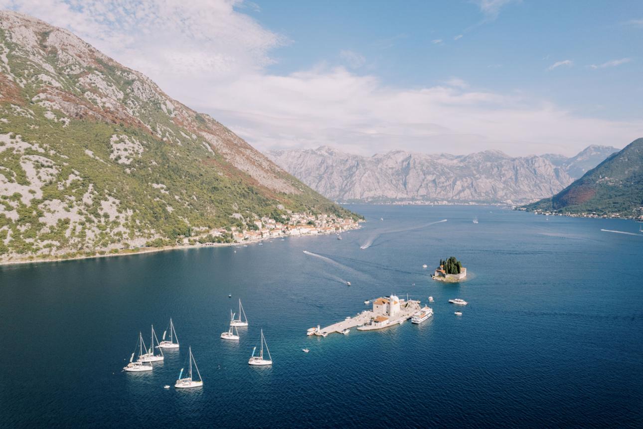
The Bay of Kotor is technically part of the Adriatic. Geographically, it behaves like nothing else in the region.
Four interconnected inlets carving 28 kilometres into the Montenegrin mountains create a body of water that is simultaneously sheltered from open-sea conditions and capable of producing its own localised weather systems that have surprised sailors who underestimated it. The result is a sailing destination that is neither beginner-simple nor expert-only — and one that rewards careful preparation in ways that few other Adriatic anchorages do.
Most Adriatic sailing happens in relatively open water between islands, where wind direction and swell follow predictable seasonal patterns. The Bay of Kotor is enclosed. Wind funnels through mountain gaps rather than blowing consistently across open water, producing the Neverin — a sudden, localised squall that can arrive with minimal warning and reach significant speeds within the bay's inner sections.
The Montenegrin Hydrometeorological Institute documents Neverin events specifically because they behave differently from the Bora or Jugo systems that define the wider Adriatic weather vocabulary. Sailors familiar with Croatian waters sometimes discover this the hard way.
This is not a reason to avoid the bay. It is a reason to sail it differently — checking local forecasts rather than regional ones, building more buffer time into anchorage plans, and seeking local knowledge from the skippers and boat operators who work these waters year-round. Platforms like Marina Smart are building exactly this kind of verified local expertise into the crew network — making it possible to connect with captains who know the bay's specific microclimates before you arrive, not after.
Perast — A baroque village of eleven churches on a peninsula, with two islands visible from the anchorage. Our Lady of the Rocks, one of those islands, was built by sailors who placed a stone each time they passed safely. It is one of the more quietly extraordinary places accessible by boat in the entire Adriatic.
Lepetane — The narrowest point of the bay, where a car ferry crosses what feels like a river rather than a sea. Anchoring here and watching the ferry traffic while eating from a bag of local cheese bought at the village above is a particular pleasure that requires no planning beyond arriving.
Tivat — Porto Montenegro, the marina development that turned a former Yugoslav naval base into one of the most technically capable superyacht facilities in the Adriatic, according to Porto Montenegro's official documentation. For charter boats, it's a practical base. For anyone interested in watching how rapidly marina infrastructure transforms coastal economies, it's also a case study worth observing firsthand.
Sailing in enclosed water requires a specific recalibration of instincts developed in open sea. Distance from shore is shorter. Anchoring depths vary more dramatically than charts sometimes suggest. The visual scale is compressed in a way that makes seamanship feel more precise and less forgiving simultaneously.
Sailors who complete a full bay circuit — entering through the Verige straits, working north to Perast, continuing to Kotor itself, and returning — consistently describe it as one of the most concentrated sailing experiences in the Adriatic: four days that feel like ten, in the best possible sense.
Kotor's medieval old town, surrounded by walls that climb 1,355 steps to a fortress above the city, is a UNESCO World Heritage Site. Arriving by boat and tying up in the town harbour means walking directly from the dock into those walls, which is a different experience from arriving by tourist bus and paying for parking. The boat earns its keep as infrastructure, not just as transport.
The French Riviera that appears in most travel photographs is real, and it is genuinely beautiful. It is also, in July and August, one of the most congested coastlines in Europe — a 115-kilometre strip between Menton and Cannes where hotels, restaurants, and beach clubs have been catering to international visitors since the 19th century, at prices and densities that reflect a century of being discovered.
The Côte d'Azur that most tourists never find is three minutes offshore by boat.
The most striking characteristic of the French Riviera's coastline viewed from a private boat is how quickly the tourist infrastructure disappears. The Promenade des Anglais, the luxury hotels stacked against the hills above Nice, the crowded beach clubs of Saint-Tropez — from 500 metres offshore, none of this dominates the view. What you see instead is the geological character of the coast: limestone and volcanic rock dropping into the Mediterranean in formations that have nothing to do with the human activity on top of them.
The sea caves near Cap d'Antibes. The calanques east of Marseille that we covered in Marseille as a Sailing Base. The secluded bays of the Lérins Islands fifteen minutes by chartered boat from Cannes, where a Cistercian monastery has operated since the 5th century and swimming off a rented boat in a bay with no road access is a materially different experience from the public beaches a few kilometres north.
These places exist within easy reach of every tourist on the Côte d'Azur. Most never reach them because getting there requires a boat rental or day charter.
Sainte-Marguerite and Saint-Honorat, the two main Lérins Islands off Cannes, are reachable by scheduled ferry — and frequently overlooked in favour of mainland beach clubs. By private boat rental, they offer something the ferry crowds don't: the ability to anchor in a quiet bay, swim in calm water, and eat lunch aboard before the day-tripper ferries arrive.
Saint-Honorat specifically — the smaller island, home to a working Cistercian monastery since 410 AD according to the Abbaye de Lérins — produces wine from vines grown on the island and opens its shop to visitors. Arriving by chartered boat, mooring off the island's eastern coast, and walking up to the monastery shop is one of the more quietly extraordinary ways to spend a morning on the Côte d'Azur — and entirely inaccessible without a boat.
Between Nice and Monaco, Villefranche-sur-Mer sits around a deep natural harbour that has sheltered boats since antiquity. The Corniche road above is one of the most famously scenic drives in Europe. The view from the water — looking up at the coloured facades of the old town from a rented boat anchored in the bay — is better than the view from the road, and accessible only from the water.
Cap Ferrat, the promontory between Villefranche and Beaulieu-sur-Mer, is one of the most expensive real estate locations in the world. Its coastline — rocky, cove-punctuated, and largely private by land — is publicly accessible by boat. Rounding the cape by day charter reveals the specific quality of Mediterranean light on white limestone that explains, better than any written description, why people have been coming to this coastline for centuries.
Day boat rental and yacht charter options exist at every major port on the Côte d'Azur — Nice, Antibes, Cannes, Saint-Tropez. Options range from small self-drive motorboats for licence-free coastal exploring to fully crewed sailing charters for multi-day itineraries.
The most common mistake is waiting until arrival to book a boat. July and August on the Côte d'Azur bring the highest boat charter demand in the Mediterranean — the best boats and most experienced skippers fill well in advance. As we covered in How to Book a Boat Online in 2026, booking through a platform with verified operators and transparent pricing before you arrive consistently produces better outcomes than walking the port and negotiating with whoever has a boat available that day.
Marina Boat App — free on the Apple App Store — is built specifically to make the French Riviera boat rental experience bookable in advance without the opacity that has historically made Mediterranean charter pricing unpredictable. We're onboarding boat rental and charter operators across the Côte d'Azur now, completely free, because we believe the market deserves better booking infrastructure. Download Marina Boat App, compare available boats near you, and take the trip you've been planning from the side of the water that actually shows you what you came to see.
Aix-en-Provence is one of those cities that visitors describe as perfect and then leave slightly unsatisfied — the way you leave a very good meal that was missing one thing you couldn't quite identify.
The city is genuinely beautiful. The Cours Mirabeau, the Saturday market, the particular quality of afternoon light that Cézanne spent his career trying to document. It delivers exactly what it promises. What it doesn't deliver, and what visitors realize they were missing only after leaving, is the water.
The Mediterranean is fifty-three kilometers from the center of Aix. Close enough to smell in the right wind. Far enough that most visitors don't bother. They stay in the city, walk the streets, eat well, and return home without understanding that the most dramatic coastal scenery in France was less than an hour's drive from where they slept.
The Calanques — the limestone fjords east of Marseille extending toward Cassis — are among the genuinely extraordinary natural environments in France. The Parc National des Calanques, established in 2012 as the only national park in France combining terrestrial and marine zones, protects a coastline that drops 400-meter white cliffs directly into water registering turquoise over a specific limestone substrate in a way that photographs consistently underrepresent.
The hiking trails reaching the best inlets — En-Vau, Morgiou, Sormiou — are long, summer heat is serious, and parking at trailheads is deliberately limited. The park closes the most popular trails on high-temperature days, which in summer is frequent.
From the water, none of this matters. A boat charter from Cassis or Marseille's Pointe Rouge marina reaches En-Vau in thirty minutes. The boat anchors inside the inlet — white cliffs on three sides, water clear to the bottom at eight meters — without a single step of hiking required to reach one of the most visually striking places in France.
The route is straightforward. Fifty minutes south to Cassis — the small port town at the eastern end of the Calanques, better parking than Marseille, more manageable scale for the visitor arriving from Aix. From Cassis, boat charters and boat rentals access the Calanques within minutes of leaving the harbor.
A half-day private boat rental from Cassis runs €200-350 for a group of four to six. Add a skipper — recommended for the unmarked anchorage entries inside the Calanques where the water shoals quickly and local knowledge matters — and the cost rises to €350-500. For a group splitting costs, the per-person expense compares favorably with any comparable experience the tourist infrastructure of Aix provides.
Full-day charter options allow the combination that works best from Aix: the Calanques in morning when light is most dramatic and other boats haven't arrived, lunch in Cassis, and either a return drive to Aix or a continuation east along the coast toward the Var.
The gap between Aix and the water is cultural as much as logistical. Aix is oriented toward its own pleasures — the cafés, the markets, the architecture, the university culture defining it for centuries. The coastal consciousness making water feel like an obvious next destination in Nice or Marseille is not structurally present in Aix.
What's changing is the visitor. The traveler arriving in Provence in 2026 increasingly knows enough about the region to look for what isn't in the guidebook. That person is actively searching for the day trip that isn't on the tour bus itinerary.
The water is the answer. Marina Boat App, free on the App Store, lists Cassis and Marseille boat charter operators — private and guided options into the Calanques — so the Aix visitor planning a water day can find, compare, and book before leaving their hotel.